Innovation, mapping and big data

Innovation often comes in small packages and it can take awhile to be adopted, it may have in fact been around for a while.

I was doing some mapping the other day, and I think a very clever innovation, that often isn’t used, is the way geospatial data can be accessed and shared across the web.

If you want to talk about big data, then start with geospatial data: it’s terrabytes of data. For decades practitioners have been sending large datasets around. It’s very common in consultancies to be sitting around waiting for a DVD or a CD of data to be sent via snail mail. Even though we only focus on one site or region, we often have large datasets covering the entire state or country. .

A new approach to sharing geospatial data, supplying data through a ‘Web Map Server’, means you don’t have to download that data onto your computer and you can ensure that it is always up to date. You request the layer through the web (you need the URL) and you can then analyse and use the data as it was on your computer. The owner of the original data will update it as required giving you confidence you have access to the current real time data. It can be requested as a WMS (raster) or WFS (vector).

There are 600 or more datasets freely available from Victoria’s data.vic.gov website. There are hundreds of simple and clean base maps that the USGS, ESRI and Open GIS provide and by the same standard, they work with any software package. Of course you’ll need a pretty good internet bandwidth!

Victoria's coastline.  A map generated using data from a web map server.

Victoria's coastline.  A map generated using data from a web map server.

So, in summary, it’s more accurate, saves you having to store gigabytes of data on your own system and saves you time. 

Try it out. 


Is a Liveable City boring?

I was at the 9th International Urban Design Conference earlier this month and it was interesting to listen to the way urban designers were critiquing the concept of a liveable city.

I have always had an issue with the way the major international agencies like Mercer and the Economic Intelligence Unit approached liveability. For example, climate is a big factor in the scoring system, but this is something city planners don’t actually do anything about. The purpose is to help large multinationals with their remuneration packages for executives, not to help city planners create better and smarter cities.

I also think that a whole city approach to liveability completely misses the spatial variability and conditions of the place. Cities change dramatically in their characters and amenity in just a kilometre.

But the movement to create liveable cities is a powerful one, and I think at its core is a movement to improve the local amenity and quality of life for residents – a fantastic goal.

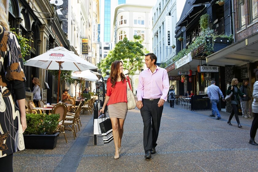
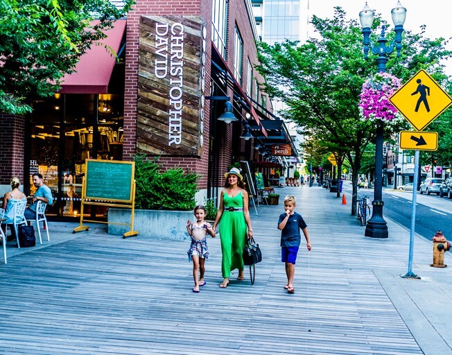
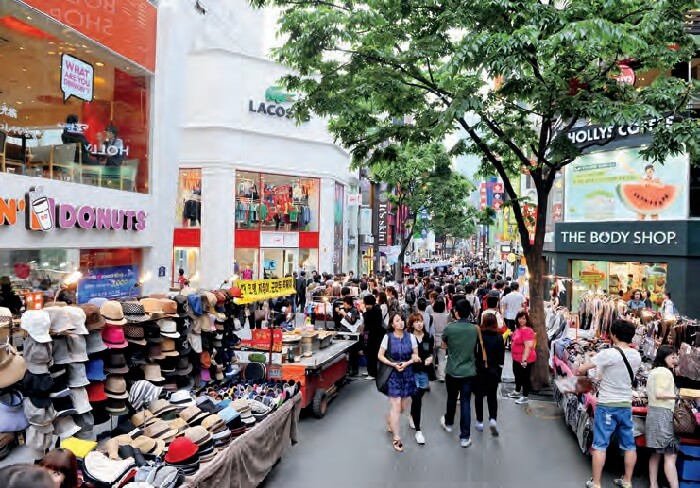
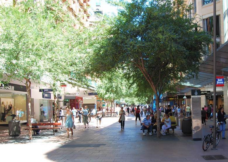
The critique that I heard at this recent conference was that this drive for walkable streets and civic squares with cafes is pushing many city planners to the same place. A boring place. Nice, but still boring, or the same. You look around and see the same brand of restaurants and cafes, the same shopping outlets, the same outdoor café style, and even the same fake grass. The key critique is that liveable cities look the same – the look and on ground outcome is the same, and perhaps we are losing the essence of the unique and local. The point is captured in these four cities: Auckland, Portland, Seoul and Sydney.

In my opinion and the approach I take when designing projects is that the essence of maintaining a sense of place and local feel is preserved through the following key design ideas:

  • Use indigenous vegetation species and PLEASE don’t use fake grass.
  • Use dynamic installations i.e. something that changes with temperature or rainfall patterns.
  • Engage local artists to tell a specific story.
  • Think more about the materials. While concrete is a builder’s favourite and glass is a shopping strip favourite, you must include and use other materials to give the place a more local feel.
  • Think vertically as well as horizontally. People don’t’ actually think and interact in a 2D world. Green walls are a fantastic way of expanding the depth to your local activity centre.

You’ll notice these actions don’t involve technology!

I want to acknowledge Stephen Moore (Roberts Day) for his presentation at the Urban Design Conference on the concept of a “Loveable City”, which inspired me to write this blog.